At EnSafe, we’re reimagining how environmental site assessments and surveys are conducted, leveraging cutting-edge tools like drones and 360° cameras to make fieldwork faster, safer, and more insightful.
Traditionally, capturing site conditions meant extensive manual data collection, lots of photos, and time-consuming documentation. Today, we use technology to streamline this process, giving our teams and clients a clearer, more accurate picture of what's happening on-site—all while reducing costs and improving safety.
How Does It Work?
We use the DroneDeploy platform to plan flights, capture imagery, and organize data from both drones and 360° cameras. This allows us to deliver high-quality outputs like:
- High-definition aerial imagery
- 3D topographic models
- 360° panoramic site walkthroughs
- Annotated maps and virtual tours
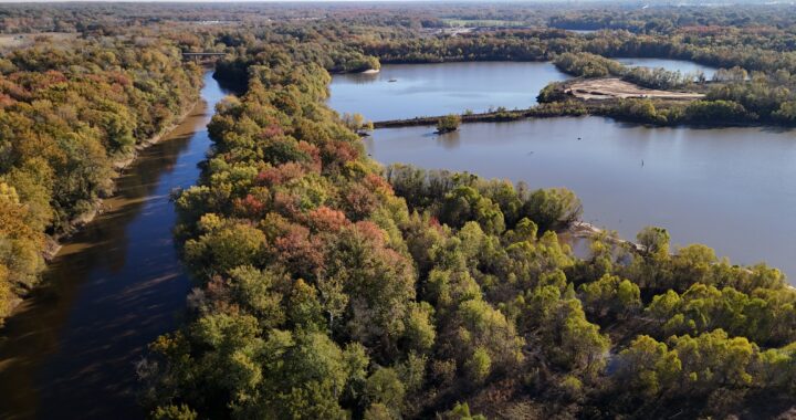
Drones can cover large, complex sites in a fraction of the time it would take on foot, capturing data that reveals features like erosion, surface changes, or stressed vegetation. The result? High-resolution orthomosaics and 3D models that offer far more detail than typical satellite imagery. Meanwhile, 360° cameras capture immersive, street-view-style visuals that allow our teams and clients to “walk” a site virtually, indoors or out. These Site Walks offer comprehensive visual coverage, reduce data gaps, and limit the need for costly remobilizations.
By combining drone and 360° camera data, environmental professionals can document an entire site with remarkable detail and efficiency. Data is geotagged and overlaid in real-time onto a DroneDeploy project, allowing users to track exactly where images and videos were taken. Field notes and observations can be added directly to the visuals, creating a centralized, collaborative platform for project teams. We’re taking site assessments to the next level with aerial maps, 3D models, and immersive 360° tours, all captured in a single field visit.
Whether you're planning a redevelopment, evaluating environmental risks, or simply looking to streamline your assessment process, EnSafe can help you do it smarter. By integrating advanced technology like drones and 360° cameras into our environmental services, we’re providing clients with faster, safer, and more comprehensive site insights, all while reducing costs. From detailed 3D models to immersive virtual walkthroughs, our tech-driven approach transforms how site data is captured and used.
Let’s connect to discuss how EnSafe’s innovative tools and deep expertise can support your next project!